Tunnels - 1st June

The ride from Bakkaåno to Flekkefjord is one of the hillier sections of the trip around south-west Norway. The road snakes around the head of Jossingfjorden, hugging the side of a vertical cliff and plunging through a dark tunnel. Good brakes and decent lights are essential. The tunnel is unlit and without lights you will not be able to see where you are going. My own lights, as you may have guessed, were not that great.
The campsite at Egenes near Flekkefjord is one of the oddest
I stayed on. The tent sections are either a small stony area of hard-standing
on top of a small hillock, or a narrow piece of grass verge outside the main
campsite. The poor facilities for tents
were almost made up for by the helpful friendliness of the owners. All night I
listened to squalls of hail and rain blowing around the lake and the hills.
The Bakkaåno to Flekkefjord map is here.
The Bakkaåno to Flekkefjord map is here.
When I set off in the morning it was cold and wet, the wind
strong from the north-west. From Flekkefjord to Feda the route follows the Old
Norway High Road – steep and gravelly but very beautiful. I had a plan to put
my bike on a bus at Feda and take a short-cut through a tunnel under
Fedafjorden to save cycling 20km round the head of the fjord. In the Co-op in
Feda they produced a timetable and told me how to get to the bus terminal. I
reached it just in time to be surrounded by buses and realised that I had no
idea which one to catch. Luckily the drivers sorted it out between them, and
ten minutes later I was standing with my bike on the other side while the
driver apologised profusely for not being able to spend more time telling me
about all the beautiful places I should make sure I didn’t miss on my trip.
Unfortunately he had a schedule to stick to, so he shook my hand and off he went.

The next section of the route started on main roads and
seemed unpromising, but eventually proved to be one of the most beautiful
sections of the journey: trees, flowers, lakes, fjords, small roads of tarmac
and good gravel. And then the sea, with a small harbour, huge waves in
glittering sunshine and great views back up the coast. Then, suddenly, there
was flat, fertile farmland and a big wind to blow me to Farsund and a campsite
which, surprise, surprise, was officially closed for the winter. I camped among
trees and fell asleep with the sound of surf in my ears. The Flekkefjord to Farsund map is here.

Tips:
- Make sure you have good lights with you.
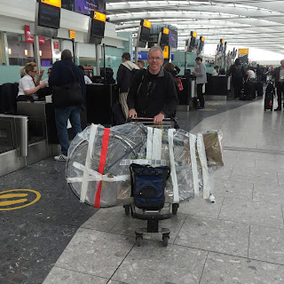
- Electrical tape is almost essential on any long bicycle tour. My GPS unit fell off twice before I figured out that the plastic mount had broken. Top marks to the Garmin though. It survived.
- On the subject of the GPS, I used free mapping downloaded from Openfietsmap. This mapping was invaluable, especially in towns and cities. In Norway I also used the Nordsjøruta Vest and Øst map packs from Castor Forlag. It's cheaper to buy them direct, and even cheaper to buy them from me once I've finished using them to write this, so let me know if you want them.


Comments
Post a Comment