A little bit lost in Sweden - Sandefjord to Stenungsund - 10th-11th June
I landed in Sweden at 3.30 in the afternoon and set off
southwards. My English friends from a few nights before had recommended a
campsite near Tanumshede and I wanted to get there that night. It was further
than I thought, but after the first few kilometres the roads were wide and
empty and there were no hills. It slowly
dawned on me that I might not see another hill until I reached England.

The
NSCR led through farmland – not a holiday home in sight that I could see, but
the route was, for the first time, 20km inland from the coast, and no doubt
that helped. It felt very empty compared to the part of Norway I’d just left,
and the feeling was intensified when I saw four huge grey cranes rise up from a
field by the roadside and flap slowly overhead.
In the small town of Tanumshede I had trouble finding an
ATM. Norway’s minibank had become Sweden’s bankomat. Then I had trouble finding the road to the
campsite. I no longer had the detailed
maps I’d been using in Norway and I was relying on my GPS. Openfietsmap is
good, but I hadn’t completely understood that the lovely blue line that marks
the NSCR disappears at certain levels of magnification in what seems to be a
random way. Maybe I was just tired – it had been a long day – but then I met a
French couple in a camper van and they told me the way. The campsite, when I
found it, was right beside the museum at Vitlyke. The owner, who I think was
called Pedro, was incredibly welcoming, and I was able to sit outside my tent
in hot sunshine. It felt like summer.
 |
| Landscape at Vitlyke |
 |
| Rock carvings. The modern red colouring is controversial. |
The carved rocks of Tanum are not to be missed, and the
museum shop at Vitlyke is excellent. I spent the morning there, enjoying the
scent of sun on pine needles, and then set off on a ride mostly along the coast
to Lysekil. During the course of the day
the inadequacy of the Swedish signposting of the route, my GPS
problems, and my lack of a decent paper map made navigation a little difficult. But it was a lovely sunny
day, so much so that my arms got accidentally sunburnt where I missed a bit
with the sunblock.

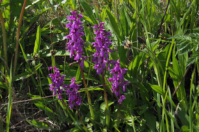
Somewhere near where this photo was taken I met a touring cyclist from Germany. He was only about the fourth long-distance traveller I'd met and we stopped to chat. I asked where he was going and he replied 'Nordkapp.' I think I said something stupid like, 'That's a long way.' We shook hands and continued with our journeys.
During the final few kilometres to Lysekil I ended up on a main road and discovered that the Swedish attitude to cyclists is entirely different to that of Norway. However, being English I felt quite at home sharing the road with heavy traffic, although I was very glad when I reached the campsite.
During the final few kilometres to Lysekil I ended up on a main road and discovered that the Swedish attitude to cyclists is entirely different to that of Norway. However, being English I felt quite at home sharing the road with heavy traffic, although I was very glad when I reached the campsite.
The following morning I went to get the ferry in Lysekil,
pausing to buy a long sleeved shirt from a sports shop to protect my sunburnt
arms. I passed a school museum which looked interesting but was very closed, and just when I was thinking I wouldn't find morning coffee I came across a chocolate shop and cafe in the woods where I ate a delicious rhubarb tart.


The road crossed another arm of the sea by a second ferry and then I got lost in a
nature reserve for a while. I cycled along, enjoying the way they like to patch their roads, enjoying the buttercups, and trying to figure out what the signs meant.


I finally emerged onto the main road to Stenungsund which was busy and unpleasant, but which led to a huge holiday campsite with a very fine little
grassy clearing for small tents right by the sea. I was able to have one of my few swims of the
trip on a warm, beautiful evening. There was a young Swiss boy camped near me, a cyclist. I asked where he was going. 'Nordkapp,' he replied, with a look of steely determination. As I travelled on I met more and more cyclists, usually solitary and usually heading for the bleak and empty northernmost tip of Europe, with that same determined look in their eyes.
Me, I just wanted to follow the summer that I seemed to have found at last.
Me, I just wanted to follow the summer that I seemed to have found at last.
 |
| The beach at Almöns Family Camping. This is the place to stay in Stenungsund.
Tips:
|
Comments
Post a Comment