Ferries and hills - 7th-8th June
The next section of the North Sea Cycle Route included
several ferries. There would have been one more if it had been running. Another week and I might have avoided a not
very enjoyable diversion through Brevik and Porsgrunn.
 |
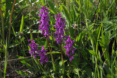
| Typical seaside scene with heartsease |
Lots more up and down and woods and small farms brought me
to Moen, where there was a boatyard and a campsite. There were cars parked everywhere and people
wandering about. It had been open day at
the boatyard, but I had arrived just too late. The campsite boasted the most
opulent camp kitchen and dining area I have ever seen and I met a bunch of
English cyclists who invited me to eat with them. The other notable feature of this campsite
was that they had a lower charge for a single camper. If only more campsites did this!
I was up early in the morning to catch a ferry in Risør, but
then realised I’d left my helmet in the camping reception the night
before. I had to ring the owner to come
down and open up, which was embarrassing.
I didn’t tell her that the helmet spent most of its time strapped to the
back of my bike. I caught the ferry in
plenty of time, a lovely old wooden boat, and then cycled along to Stabbestad
about 15 km away. As I neared the village
I saw a group of cycle tourists heading my way and I suspected, rightly as it
turned out, that they had just come off a ferry. I had misread the timetable and had a two
hour wait for the next one. It was a
pleasant wait in the sunshine, watching all the ferries which weren’t mine
coming and going among the islands and fjords. Eventually the ferry did come
and made its way to Kragerø. I
experienced a weird optical illusion on the boat, thinking that groups of
houses on a rocky headland were model houses, part of an extensive model
village. It was only when I saw a car
moving that the whole thing fell back into its proper scale.
Kragerø is another seaside tourist town. I searched for a
post office, but failed to find one. Then I searched for the North Sea Cycle
Route out of Kragerø which I managed to find and which turned out to take a
ridiculously tortuous diversion. It was
only when I rejoined the main road that I remembered the advice of my English
friends of the previous night to go straight through the town.
The final section of the day’s ride took me over the
steepest roads of the entire route around the North Sea. A gravel track leads
through the woods towards the beach at Rognstranda. Luckily the steepest sections are tarmacked
and someone has amusingly painted the gradients on the road surface – 22% . .
.25% . . . and finally 28%. I admit that I pushed my bike up these.
I was glad to arrive at the campsite, but once again I
forgot the advice of my English friends until it was too late. Rognstranda is an amazing place, a UNESCO
geo-park sited on a massive geological fault line. Where better to put a massive campsite than right on the fault line itself? The campsite owner was very proud of his electronic key system, and of the piped music in the toilet blocks. He was so proud that he selected my pitch for
me and took me there himself. I’d put the tent up when I remembered the advice –
“He’ll try to tell you where to pitch but just ignore him and you can camp
right next to the beach.” I was too
tired to move the tent.
 |
| 500 million year old rocks at Rognstranda |
The piped music was terrible!
Tips:
Tips:
- When you have your ferry timetable, make sure you read it carefully
- The advice people give you is only useful if you remember it at the right time


Comments
Post a Comment